If you’re searching for a map of Cádiz, you’re in the right place. This detailed Cádiz tourist map from the Cádiz tourist board helps you navigate the city with ease. It highlights key landmarks, historic districts, beaches, and transport links so you can plan your visit confidently.
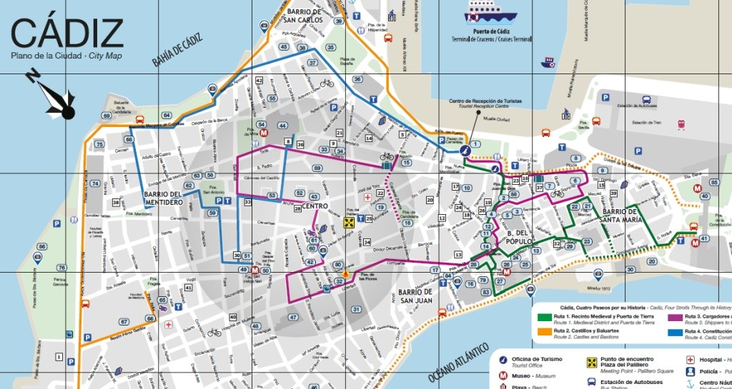
This downloadable map offers a clear layout of Cádiz’s most important areas. You’ll find iconic neighbourhoods like El Pópulo and La Viña, alongside major attractions such as the Cathedral, Tavira Tower, and the Roman Theatre. Moreover, the map includes practical information like hotels, viewpoints, and transport hubs, making it useful for both first-time visitors and returning travellers.
Because Cádiz is compact yet full of history, having a reliable map makes a big difference. From scenic coastal walks along Campo del Sur to exploring plazas like Plaza de San Juan de Dios, everything becomes easier to locate and enjoy.
This map is available for download on the official tourist information website for Cádiz.
I’ve been living in this lovely area of Western Andalucia for the last 20 years or so and dedicate most of my time to the running of English language tourist information websites for the towns of Cádiz, Ronda, Grazalema, the famous or infamous Caminito del Rey, and also Wildside Holidays, which promotes sustainable and eco-friendly businesses running wildlife and walking holidays in Spain. My articles contain affiliate links that will help you reserve a hotel, bus, train or activity in the area. You don’t pay more, but by using them you do support this website. Thankyou!